Chasing Stone Giants
The Southern Oregon Coast is lined with striking sea stacks that form a scenic trail along the shore. Wind, waves, and the hands of time have each etched their mark on these ancient stone giants. As you follow the trail, chasing these stone giants, look for headlands standing firm, arches mid-collapse, and stacks that have stood alone for centuries. Here are six sea stack locations you won’t want to miss.
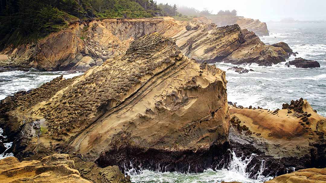
1. Cape Arago: Otherworldly Views
To the north, Cape Arago marks the first major cluster of sea stacks. The headland here is built mostly from soft, uplifted marine sedimentary rock, which explains the rounded, horizontally banded, otherworldly look. Peer closely at the headlands and you’ll spot active erosion in progress, sea caves cut into the base of several cliffs, and partially formed arches visible at low tide.
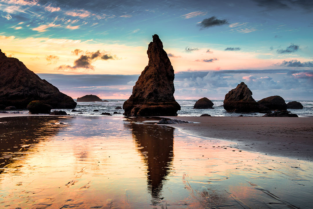
2. Face Rock: Legend Meets Geology
Face Rock on Bandon Beach may be the most recognizable sea stack on the Oregon Coast. Its unmistakable profile resembles a face tilted skyward. Tradition holds that a young woman named Ewauna waded into the sea and was seized by a malevolent water spirit. Refusing to look at her captor, she kept her eyes fixed on the sky and was forever turned to stone. Nearby formations, including Cat and Kittens Rocks, represent her animal companions, who shared her fate.
The beach is also home to many other sea stacks, including Table Rock, Castle Rock, Elephant Rock, and Wizard’s Hat. When this beach opens up at low tide, it’s one of the best spots to walk right up to and explore multiple sea stacks in a single visit.
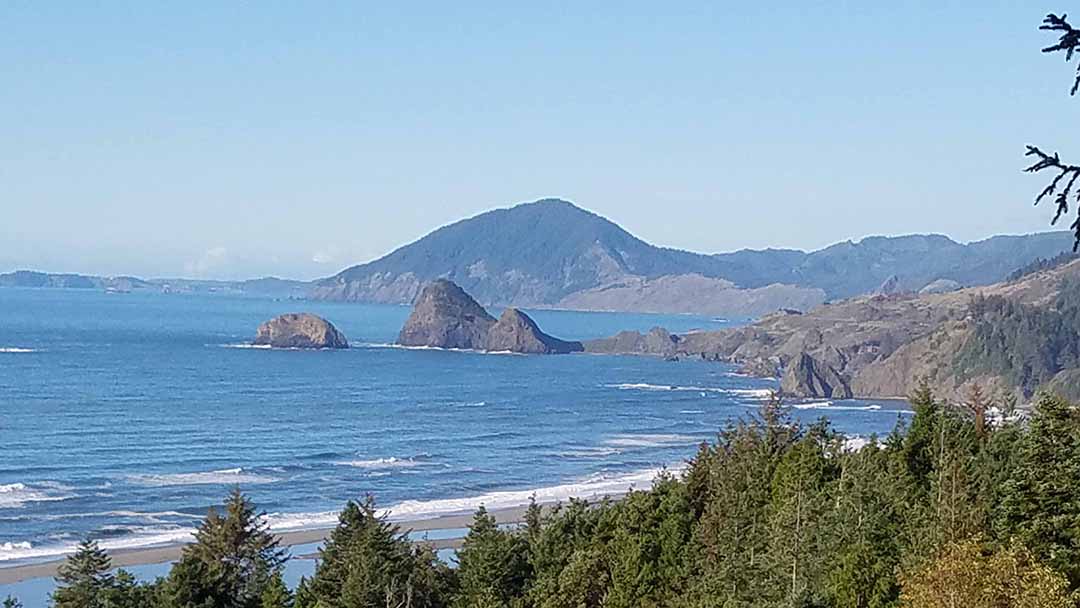
3. Battle Rock to Sisters Rocks: Coastal & Baseline Views
Battle Rock, the most historically significant formation in Port Orford, is named for a bloody battle between settlers and indigenous peoples. At low tide, a rough path allows visitors to scramble to the top, one of the few stacks that allow it. The elevated view offers some of the most gorgeous coastline you’ll find anywhere.
Sisters Rocks, south of Port Orford, are a cluster of large, angular sea stacks rising abruptly from the surf. A short trail reaches the beach, and lower tides open up enough sand to walk close to the base of the rocks… an experience that makes the sheer scale of these formations genuinely visceral.
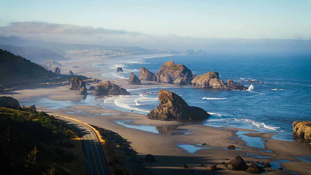
4. Cape Sebastian Corridor: Accessibility & Panoramic Views
At the start of the Cape Sebastian Scenic Corridor, just south of Gold Beach, Kissing Rock rises dramatically up from the sand. Legend has it that the rock earned its name as a romantic meeting spot for couples, and marriage proposals still happen there today.
Cape Sebastian Viewpoint sits more than 200 feet above sea level and offers the best panoramic views on the trail, with sightlines stretching up to 43 miles in both directions.
Meyers Creek Beach is fronted by a dense grouping of sea stacks, all just a short walk from the pullout. Locals say you can spot as many as seventeen faces in the rocks, though some only appear in the right light and from the right vantage point. The easy beach walk helps, letting you see the formations from several angles.
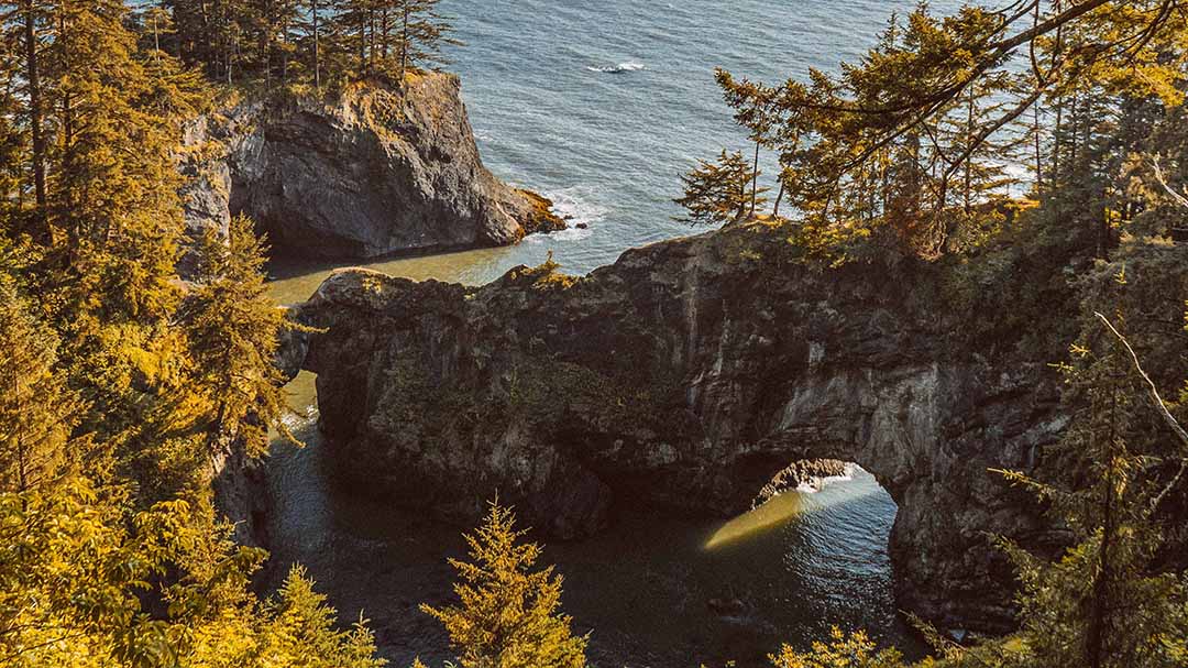
5. Boardman Corridor: Oregon’s Natural Arch Capital
Samuel H. Boardman State Scenic Corridor holds one of the highest concentrations of natural arches anywhere on the Oregon Coast, and accessing it requires little more than pulling off the highway at any of several well-marked viewpoints.
Arch Rock, the corridor’s most recognizable formation, is a wave-carved tunnel producing a framed view of the ocean, which shifts with the tides and angle of the sun.
Natural Bridges Cove takes its name from a series of closely spaced arches and partially collapsed sea tunnels visible from the overlook. It’s one of the best places on the trail to see the full arc of arch-to-stack transition.
At Whaleshead Beach, a large basalt stack with a profile resembling a surfacing whale stands out most clearly at certain tide levels. Catch it from the Whaleshead Viewpoint, or drive down to the beach for a closer look.
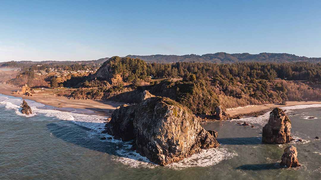
6. Harris Beach State Park: A Sheltered Coastline
The trail’s southern anchor is Harris Beach State Park with its cluster of offshore islands and sea stacks. The largest is Goat Island, a relatively intact formation. Rather than a thin, eroding stack, the island reflects its basaltic composition and position along a slightly more sheltered stretch of coastline.
Plan Your Southern Oregon Coast Sea Stack Trail Excursion
The Southern Oregon Coast Sea Stack Trail displays the coastline’s entire lifecycle, from intact headlands to natural arches to solitary stone pillars. Each stop captures a different moment in a geological process that has run for millions of years and will continue long after today’s formations have crumbled into the sea.
Plan on at least a full day for this drive, ideally two. The best views rarely come from the highway itself. An overnight in Bandon, Port Orford, or Gold Beach lets you slow down and savor every stop.
Frequently Asked Questions About Southern Oregon Coast Sea Stacks
What are sea stacks and how do they form?
Sea stacks are isolated rock pillars rising out of the ocean, separated from the mainland by centuries of wave erosion. On the Oregon Coast, the process begins with a headland, a resistant point of land, that waves gradually hollow into sea caves. When caves on opposite sides of the headland break through and meet, they form a natural arch. When that arch eventually collapses, the remaining pillar is a sea stack. Oregon coast geology, driven by the Cascadia Subduction Zone and a mix of volcanic basalt and marine sedimentary rock, produces ideal conditions for this process.
Where are the best sea stacks on the Southern Oregon Coast?
Top sea stack destinations along the Southern Oregon Coast include Face Rock, Battle Rock, Sisters Rocks, the offshore formations clustered near Meyers Creek Beach, the natural arches of Samuel H. Boardman State Scenic Corridor, the rock formations of Harris Beach, the offshore islands at Cape Arago, and the panoramic views from Cape Sebastian. Most are accessible directly from Highway 101.
How long does it take to tour the sea stacks on the Southern Oregon Coast?
Without stops, the drive from the north end of the Southern Oregon Coast Sea Stack Trail at Cape Arago to the southern anchor at Harris Beach in Brookings takes about two and a half hours. But the best views rarely come from the highway itself. They’re waiting along the short trails and overlooks just off of it. Plan on a full day, or ideally two. An overnight in Bandon, Port Orford, or Gold Beach lets you slow down and savor every stop.
What is the best time of year to visit sea stacks on the Southern Oregon Coast?
Late spring through early fall offers the most reliable visibility and calmest weather for viewing sea stacks. Winter brings dramatic wave action and moody storm light that makes for striking photography. However, increased surf and wind require extra caution near cliff edges and rocky shorelines. Summer weekends at popular spots like Face Rock in Bandon and the Boardman Corridor can be busy. Arriving early in the morning improves chances for parking and lighting.
Is it safe to walk near sea stacks at low tide on the Oregon Coast?
It can be safe to walk near sea stacks on the Oregon Coast, and many beaches allow close access to sea stacks at low tide. Always check local tide charts before heading out, stay alert to wave conditions, and never turn your back on the ocean near rocky shores. Sneaker waves, unexpectedly large waves that strike without warning, are a documented hazard along the Oregon Coast and have caused fatalities. Stay well back from the water’s edge when waves are active. For more tips on how to stay safe, visit the Travel Southern Oregon Coast Beach Safety page.
Can I climb on sea stacks on the Southern Oregon Coast?
Sea stacks along the Oregon Coast are protected as part of the Oregon Islands National Wildlife Refuge (NWR), so climbing them is off-limits. Many South Coast sea stacks are nesting sites for coastal birds, so any disturbance is prohibited. Most are closed to the public, and drones are also prohibited. Coquille Point in Bandon is the only part of the refuge open to visitors, but restrictions still apply. Since Battle Rock in Port Orford is connected to land, it isn’t considered part of the refuge, making it one of the few sea stacks you can climb.
What should I bring on a Southern Oregon Coast sea stack road trip?
Pack layers for a road trip on the Southern Oregon Coast. Coastal weather changes quickly, and temperatures can drop significantly near the water even in summer. Bring binoculars for wildlife viewing, a tide chart app or printed tide tables, sturdy shoes for short coastal trails, and a charged phone or camera. If you plan to walk on beaches near sea stacks, check tide predictions in advance and allow extra time at each stop.
